Dryline Thunderstorms Continue in West Texas

WEST TEXAS - A dryline will help to trigger storms on the southern side of the severe potential overnight and through Tuesday. For more on the rest of the Great Plains severe weather potential, read this related article.
What is a dryline?
It's a boundary in the atmosphere that separates moist air from dry air. In the same way, a cold front separates cold air from warm air. It helps to trigger thunderstorms, and the forecast supports that through tonight in west Texas.
Overnight - Tuesday
As we head deeper into the work week, the dryline will perhaps trigger an additional storm or two overnight, and again for Tuesday along with the tail end of a cold front. For this region of the country, we remain under an ENHANCED (level 3 out of 5) risk for severe thunderstorms for both days.
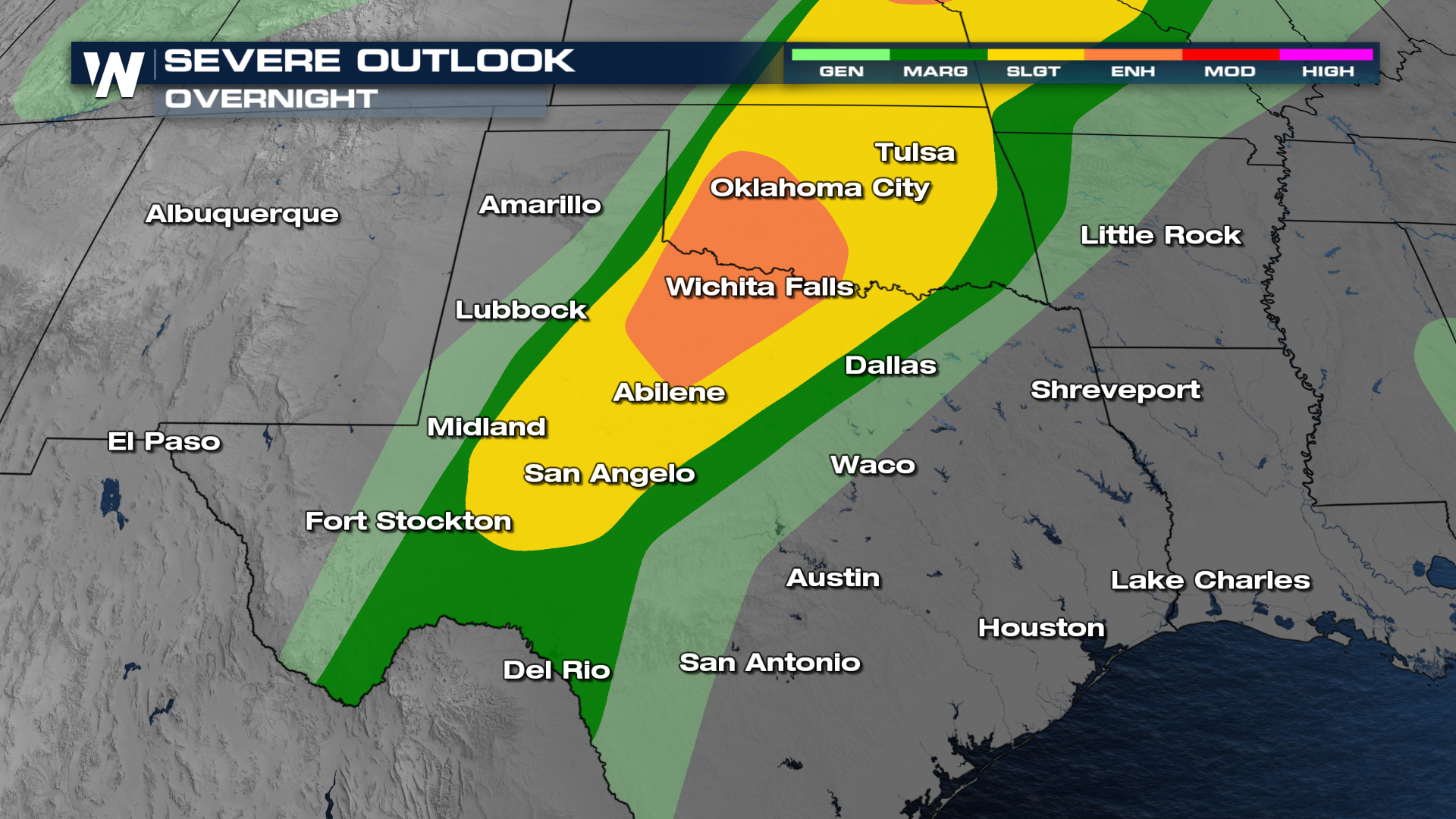
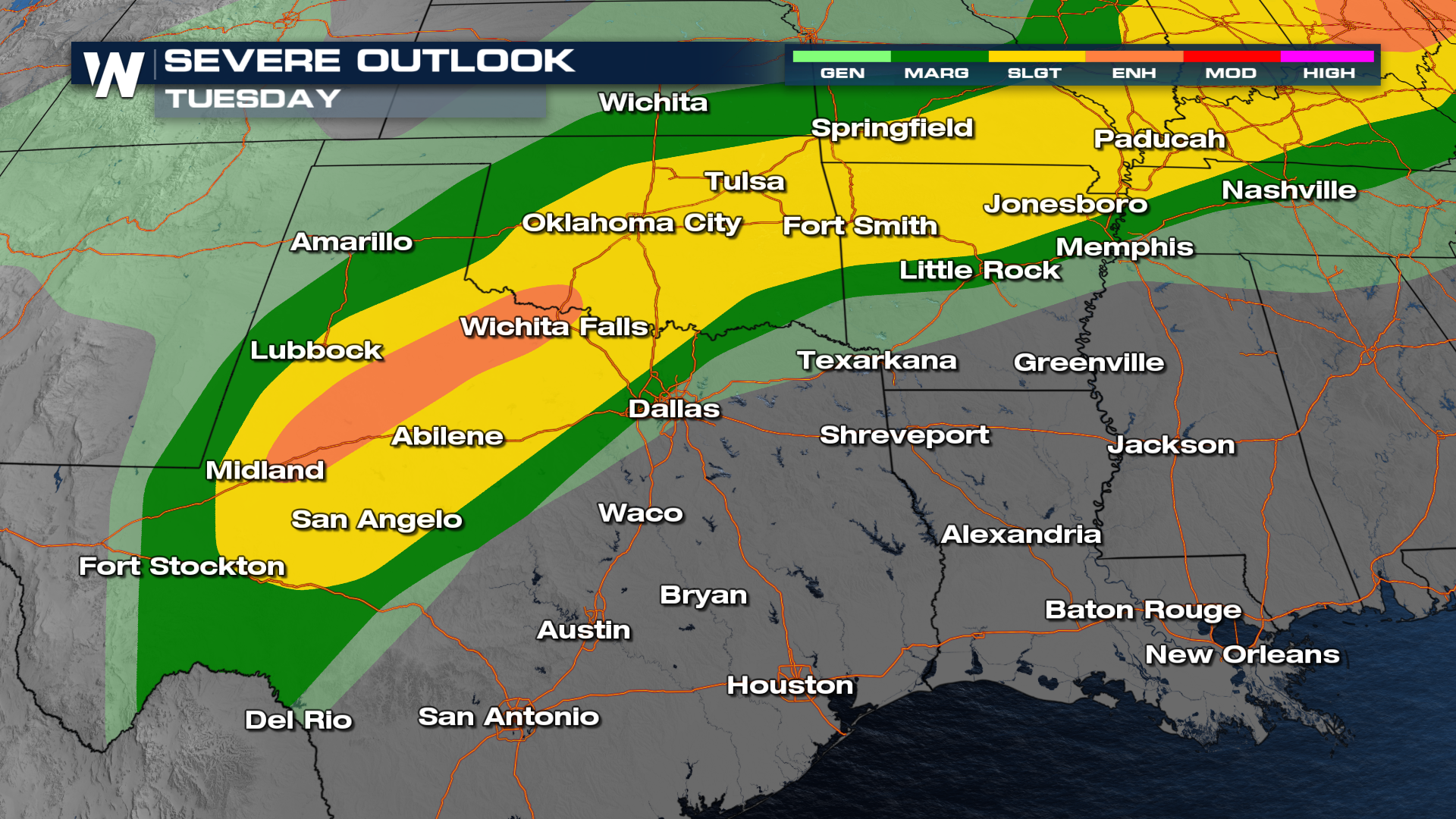
The timing of thunderstorms looks to be influenced by daytime heating. Based on model trends, Tuesday's storms look to be more widespread across Texas, Oklahoma, and into the Ozarks.
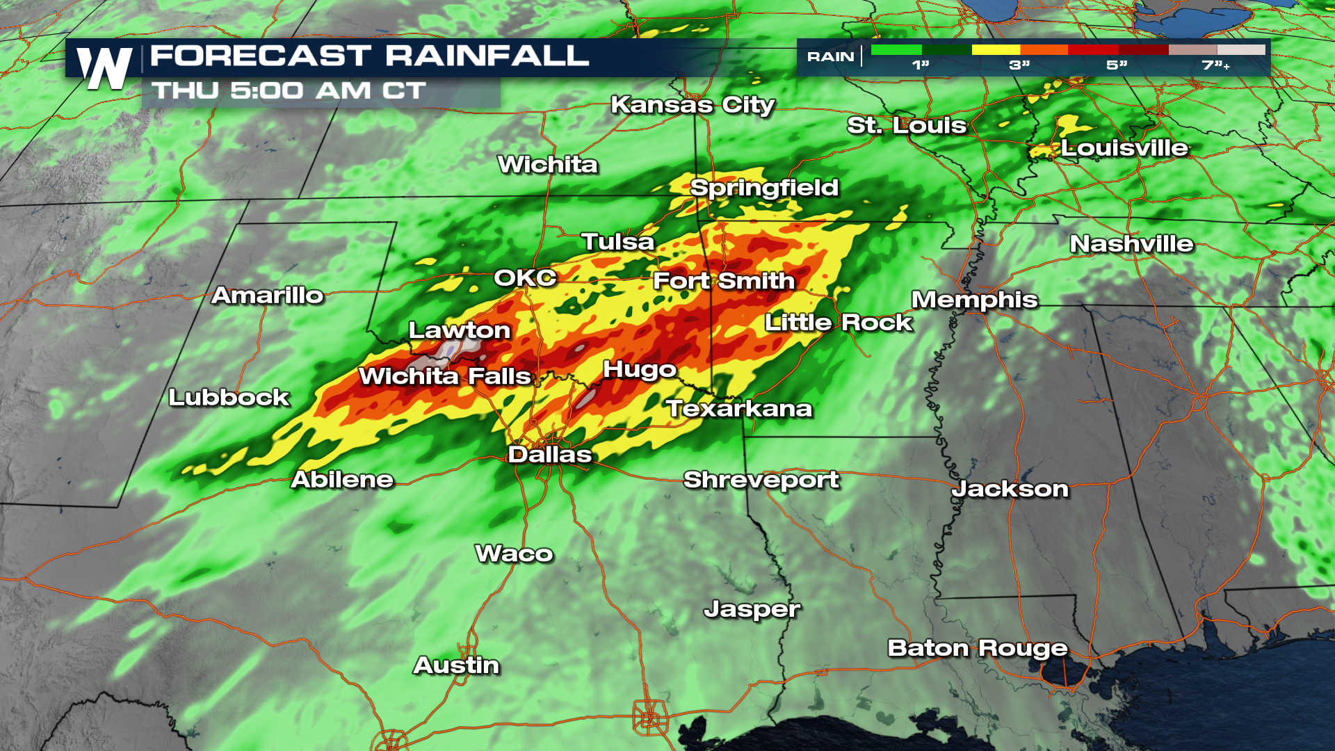
With training rain in some areas, there are excessive rainfall outlooks issued overnight, Tuesday, and Wednesday across the southern Plains. Some locations may see up to 3-5" of rainfall with higher localized totals.
For more details, be sure to join us on WeatherNation!


